Drones
North Western IFCA have two drones to assist with fisheries enforcement and science activities. Drones are Small Unmanned Aircrafts (SUA), within Unmanned Aerial Systems (UAS) as defined by the Civil Aviation Authority. Drones are typically miniature aircrafts controlled from the ground by a pilot; they can have various camera attachments and have recording capabilities.
The use of drones is seen widely across law enforcement agencies, in the detection of crimes and the evidencing of offences. Drones can be used in dynamic environments, as a fast response to monitor, record and evidence illegal activity that may not otherwise be seen, as well as being used for routine observations and checks.
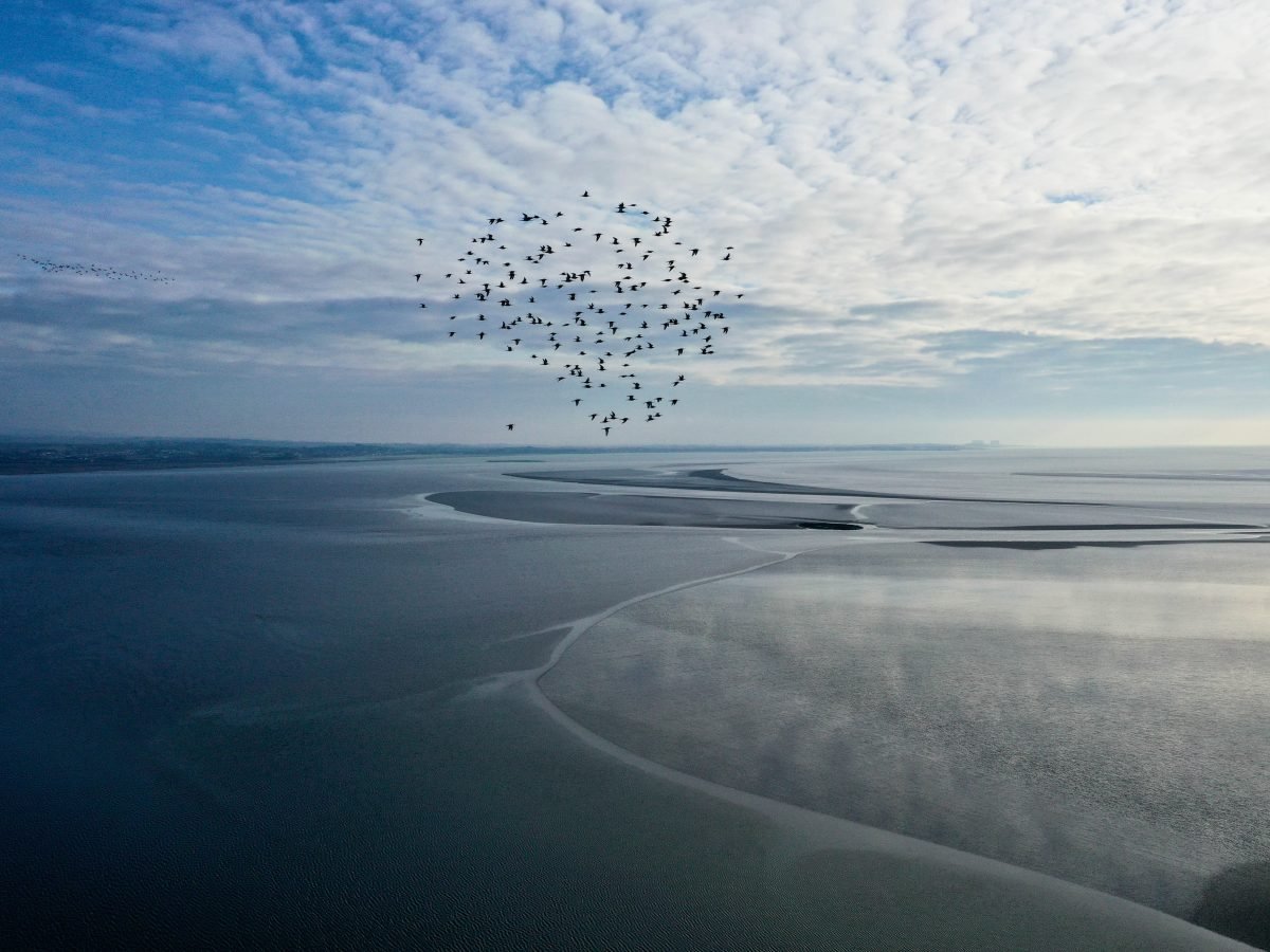
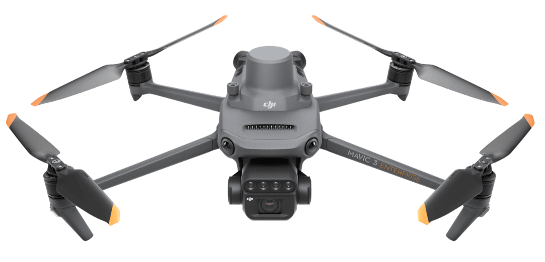
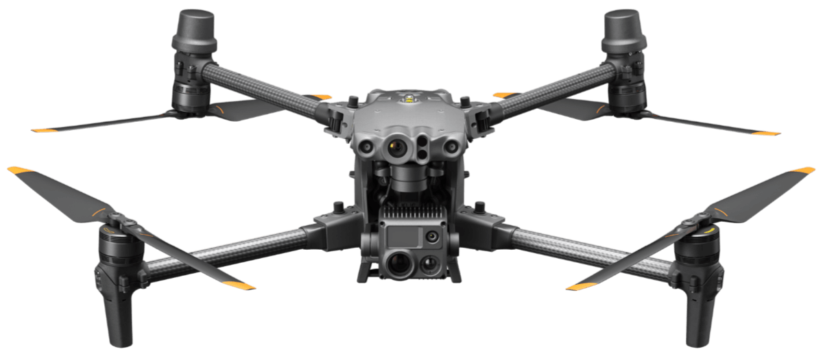
The drones used by North Western IFCA for fisheries enforcement, management and research is DJI Matrice 30T. The camera features a laser rangefinder, thermal imaging, zoom and wide angle functions, which, in addition to GPS technology, will assist the detection and evidencing of offences. The drone used by our our science is DJI Mavic 3M drone. This will be used for site surveys, to observe and monitor Marine Protected Areas (MPAs), European Marine Site (EMS) and other areas of environmental concern, which will subsequently feed into management measures.
North Western IFCA have worked with heliguy™ to procure both drones and train IFCOs and our Science Team as Drone Pilots. Follow the link here to find out more about the work we’ve been doing with heliguy on multispectral drone data to improve our mussel surveys.
Drone FAQs
What is a drone?
Drones, also known as unmanned aerial vehicles (UAVs), are small remote-controlled aircraft. The drone is piloted from the ground by a person who has undergone training and proven a level of competence. Drones typically have other equipment on board, such as a device to captures images allowing it to take photographs and videos.
What type of drone does North Western IFCA have?
North Western IFCA owns two drones, the first is the DJI Mavic 3M drone with two fixed cameras. This is our Science Team’s drone. The drone has a maximum flight time of 43 minutes, a maximum speed of 21 m/s and can fly in wind speeds of up to 12m/s. The drones camera system are a 5MP Multispectral camera and 20MP RGB Camera. These cameras are ideal for survey work. Our enforcement drone is a DJI Matrice 30T with four camera systems. the drone has a maximum flight time of 41 minutes, a maximum speed of 23m/s and can fly in wind speeds of up to 12m/s. The four cameras are zoom, wide, thermal and first person view (FPV). The drone also has a laser and thermal sensing system.
How high can the drone fly and stay in the air?
The drones can be legally flown to a maximum height of 400ft (120m). This limit is set by the Civil Aviation Authority so drones do not interfere with aircraft which operate just above at 500ft. The Mavic 3M drone is powered by rechargeable batteries and fully charged these can allow a maximum flight time of 43 minutes. The Matrice 30T is also powered by rechargeable batteries and when fully charged has a maximum flight time of 41 minutes.
What is North Western IFCA using the drone for?
NWIFCA will be using the drones as an extra resource to supplement both their compliance and management responsibilities. The enhanced capability it offers to record evidence of possible offences using the onboard camera from perspectives not previously possible will improve the prevention (deterrent) and detection of offending.
Is the drone just going to be used for enforcement or will the drone be used for research purposes as well?
Yes. NWIFCA will be looking to use the drones to enhance its ability to carry out research. The aerial ability to capture and record images and data also contribute towards an improved surveying capability and will further our understanding of fishing activity in the District which can feed into management measures and evaluation.
How do North Western IFCA advertise it is using a drone?
NWIFCA will advertise its use of drones through its website, social media and national publications. The use of drones will be highlighted through NWIFCA’s regular correspondence with Industry and the wider community, and furthermore, in regards to specific enforcement applications it is highlighted to industry on any newly issued permits.
Is the drone just being used to spy on fishermen?
Absolutely not. The drone capability has been widely publicised to Industry and the wider community, furthermore, when in use the drones will be operated overtly in full view of the community by officers in North Western IFCA uniform. When used in relation to the fishing industry the drone will be used primarily as an evidence gathering tool in the detection of offences, however this will also serve to support legitimate fishers by demonstrating their compliance with regulations to the Authority and wider community, with first-hand evidence obtained through the drone deployment.
Who pilots the drone?
The drones will be flown by North Western IFCA officers who will be assisted by other officers in the role of Observers. Only officers who are trained will be permitted to fly the North Western IFCA drones. This will consist of completing a GVC VLOS course through an accredited Civil Aviation Authority trainer and operating under a Civil Aviation Authority Authorisation.
Are the officers trained to fly the drone?
All officers who fly the North Western IFCA drones will have completed and passed a rigorous training course (the same taken by other UK Emergency Services), further they will all have passed the relevant qualifications as set by the Civil Aviation Authority and be required to maintain a minimum number of flying hours to maintain and build on existing skills.
What is the range between controller and drone?
The drones must follow all Civil Aviation Authority regulations and fly within 500m of the pilot. The drones cannot fly outside of the pilot’s line of sight unless a second pilot is used.
Does the drone comply with UK law?
Yes, North Western IFCA comply with all UK law as determined by the Civil Aviation Authority with regards to the use of the drones. This includes registration of the drone with the Civil Aviation Authority, having in place a certified Operation Manual, only being flown by appropriately trained persons, and complying with various restrictions in regard to where and how the drone is flown.
How long is data kept?
Data (e.g. video) will only be recorded where it is necessary, such as to record evidence or for scientific purposes. Those data which are recorded for evidential purposes will be kept securely, as required under data protection laws, and only be maintained for the duration of the investigation.
Do you comply with the guiding principles of the Surveillance Camera Code of Practice?
Yes, we have completed the Surveillance Camera Commissioner (SCC) self-assessment tool to ensure that our use of drones complies with the Code of Practice. You can download a copy of our report to find out more . We have also completed a specific Privacy Notice for the drones.
Will North Western IFCA be working with/using the drone with other partner organisations?
Yes, where appropriate and possible North Western IFCA intend to work with partner agencies under Section 174 of Marine and Coastal Access Act 2009.
If I have any queries or concerns relating to North Western IFCA’s drone use who do I contact?
Any views can be shared with NWIFCA via the ‘Contact Us’ section on our website. Alternatively, officers will be happy to speak with you if you have any queries when you see them on patrol.